Fern Bay and North Stockton Strategy
Port Stephens Council and City of Newcastle have teamed up to deliver a land use strategy for Fern Bay and North Stockton. The Fern Bay and North Stockton Strategy came into effect on 14 April 2020.
The plan focuses on achieving 5 goals:
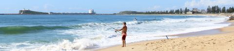
- Environment: Protect the treasured and unique Stockton Bight for future generations and attract responsible heritage and nature-based tourism.
- Town Centre: Establish a conveniently located mixed-use town centre connected by technology, transport, housing and great public places.
- Housing: Grow a resilient coastal community with access to liveable and diverse housing.
- Open Space and Community Facilities: Improve access to useable open spaces and well-designed community facilities to support daily activity and healthy lifestyles.
- Transport: Prioritise safe and convenient travel by walking, cycling and use of public transport while maintaining regional journeys on Nelson Bay Road.
Land use and infrastructure outcomes have been identified to achieve the goals. The outcomes are listed under the respective Precinct Plan developed for 6 distinct precincts in Fern Bay and North Stockton.
Latest update
Fern Bay update - February 2024
General
- Investigate a Tomaree to Stockton walk (involving boardwalk/trails and observation decks) to link with the Great North Walk.
- Investigate the establishment of formal walking trails (including directional, educational and interpretational signage) to link Seaside Estate and the Rifle Range site with the WCL and existing beach access.
- Implementation of the Stockton Public Domain Plan and Traffic Plan.
- Review the residential uses permissible within the B2 Local Centre zone under the NLEP to ensure consistency with the Newcastle Local Planning Strategy.
- Invite the community on a place making journey to activate public places and revitalise the centre. More community events and activities that celebrate Stockton's history, heritage and culture are to be carried out.
- Investigate future ownership of the beachfront land within the Plan Area to enable continuous public access to the beach from Stockton to the WCL.
- Investigate the feasibility of a new modern library at the proposed mixed-use town centre.
- Implement outcomes from community feedback to improve parks, amenities, tree plantings and landscaping.
- Provide a shared path from Seaside Boulevard, along the access trail to the east of Newcastle Golf Club, through to Popplewell Road then link up with the existing shared path to the east of Nelson Bay Road. This could also include a link to the rear of Bayway village. Map reference P3.
- Indicative shared path providing a link between future development of the Rifle Range, potential mixed-use town centre and Fort Wallace sites. The location of this path would be determined pending detailed design of these developments. Map reference P4.
- A future road link should be provided connecting the existing Fern Bay residential area through to North Stockton (Fullerton Street). The road would pass through the Rifle Range, the potential mixed-use town centre and Fort Wallace sites. Ensure relevant site specific DCP Sections allows for a road link connecting the three sites.
- Relocate, upgrade or construct bus stops in accordance with the Seca Traffic and Transport Study.
- Widening of Nelson Bay Road to two lanes of travel in each direction between Vardon Road and Seaside Boulevard.
- Investigate the feasibility for an electric bike sharing service operating between Corroba Oval (and/or the future mixed-use town centre) and the Stockton Ferry Terminal.
Precinct 1: North Stockton
- Investigate the heritage listing of the Fort Wallace Site to determine if it should be included in the NLEP 2012, State Heritage Register and/or remain on the Commonwealth Heritage List.
- Review public access points to Stockton Beach, considering the impact on coastal erosion.
- Site 1: Liaise with land owner to discuss future use of site. The site remains operational and no decision has been made by the State government regarding future use of the site. A masterplan to outline how the site can be redeveloped into the future is required to support any future change in land use. The masterplan process is to consider (but is not limited to) connections to adjacent sites, access to Stockton Beach, heritage and environmental opportunities, dwelling type and yield (including provision of affordable housing), location of mixed-use town centre incorporating commercial, residential, tourist and visitor accommodation, open space and community uses.
- Provide housing incorporated with a mixed-use town centre comprising residential (low - medium density) accommodation, commercial, community and recreation uses.
- The envisaged potential land uses would allow the existing uses on the site to continue.
- Fort Wallace – Proceed with planning proposal as per the Gateway Determination to allow part of the site to be zoned R2 Low Density Residential.
- Liaise with CMCA, Hunter Water, landowners and any other relevant stakeholders to identify a preferred location for the establishment of an RV/campground within the Plan Area.
- Upgrade the existing bus stop on the eastern side of Fullerton Street, adjacent to the Fort Wallace access, to provide seating and shelter.
- Remove the signage for the bus stop to the immediate north of the Stockton Bridge. Upgrade the existing bus stop on the western side of Nelson Bay Road, adjacent to the Stockton Cemetery access, to provide seating and shelter. This would be developed in conjunction with a pedestrian refuge to be provided in this location.
- Provide a bus stop with seating and shelter along the western side of Fullerton Street, opposite the access to the potential future mixed-use town centre. Encouraging safe crossing of Fullerton Street at the existing pedestrian (zebra) crossing in this location.
- Review the operation of the roundabout intersection at Nelson Bay Road / Fullerton Street prior to planning for the North Stockton Precinct which may not be required if the predicted level of background growth or future development is not realised.
- There may be a future opportunity to establish a ferry terminal at North Stockton to support growth in the longer term. An existing boat ramp at North Stockton (south of Corroba Oval) has recently been upgraded. This opportunity could be further investigated in the future.
Precinct 2: Original Fern Bay
- Provide housing incorporated with a mixed-use town centre comprising residential (low - medium density) accommodation, commercial, community and recreation uses.
- Undertake feasibility modelling to identify incentives or necessary amendments to planning controls to encourage infill housing development in Original Fern Bay.
- Consult with the NSW Department of Education on potential growth scenarios and the provision of educational facilities and advocate for the provision of preschools.
- Upgrade the existing bus stop on the western side of Nelson Bay Road, adjacent to the Palm Lakes Resort access, to provide seating and shelter.
- Relocate the existing bus stop on the eastern side of Nelson Bay Road, north of Vardon Road, to the south of Vardon Road. This relocation will allow for sufficient area to provide a bus stop with seating and shelter located in close proximity to the future signalised intersection of Nelson Bay Road and Vardon Road allowing for pedestrian phases on the signals.
- Provide a bus stop with seating and shelter along the western side of Nelson Bay Road, to the north of Vardon Road, to encourage safe crossing at the future signalised intersection.
- Upgrade the existing footpath along the eastern side of Nelson Bay Road, between Bayway Village and Braid Road, to provide a shared path along the length of Nelson Bay Road through the locality.
- Extend the existing footpath, along the frontage of the residential developments on the western side of Nelson Bay Road, to the south to Vardon Road providing connection for pedestrians to cross safely at the future signalised intersection of Nelson Bay Road and Vardon Road.
- Provide a suitably located refuge island at Nelson Bay Road near Palm Lakes / Bayway Village.
- Construct traffic signals and pedestrian crossing at the intersection of Vardon Road and Nelson Bay in conjunction with the Rifle Range Planning Proposal to allow the safe crossing of Nelson Bay Road for pedestrians and enable safe vehicular access onto Nelson Bay Road.
Precinct 3: Beachfront
- Review the heritage significance of the Rifle Range site through the assessment of the Request to Amend the Port Stephens Local Environmental Plan.
- Undertake a detailed assessment of the 'Request to Amend the Port Stephens Local Environmental Plan' submitted by DHA for the Rifle Range site.
- Support the proposed town centre (preferred option 1 or 2) by providing medium density housing within walkable distances.
- Provide new public open space with integrated public access to Stockton Beach and Worimi Conservation Lands.
- Provide an internal bus stop as part of the future development of the Rifle Range Site. Consideration should be given to providing bus services through the existing Fern Bay residential area, to service the adjacent Rifle Range site. Existing bus routes along Nelson Bay Road could divert to loop through the area, entering at the proposed signalised intersection with Vardon Road from both directions. The route could then proceed along Vardon Road onto Popplewell Road to link with the future access for the Rifle Range development. A suitable area would be required for set down, as well as a turn-around area or roundabout to allow for a bus to exit via the same route (similar to that of Seaside Estate).
Precinct 4: Sports
- Investigate a new Sporting Precinct at Corroba Oval. Including, multipurpose courts, additional playing fields, parking, amenities building and undercover seating.
- Consider constructing a pedestrian refuge island on Fullerton Street to ensure safe pedestrian access to Corroba Oval.
- Request RMS to review the 70km/hr speed limit on Fullerton Street and considered a reduction to 50km/hr.
- Consider electric bikes and charge stations at the proposed Sporting Precinct at Corroba Oval or the mixed-use town centre and Stockton Ferry terminal.
- Advocate to Transport NSW for a new ferry terminal at North Stockton. A potential location is the existing boat ramp that has recently been upgraded.
Precinct 5: Seaside Estate
- Undertake a detailed assessment of the 'Request to Amend the Port Stephens Local Environmental Plan' submitted for 2 Seaside Boulevarde, Fern Bay.
- Continue investigations to improve recreational and community facilities at Seaside Estate, including public toilets within the development.
- Relocate and upgrade (seating and shelter) the existing Seaside Estate bus stop further east along Seaside Boulevard to provide greater connectivity for local residents.
Precinct 6: Fullerton Cove
- Consider rezoning land mapped as containing an endangered ecological community to an environmental zone.
- Undertake a detailed assessment of the 'Request to Amend the Port Stephens Local Environmental Plan' submitted for 42 Fullerton Cove Road, Fullerton Cove.
- Provide seating and shelter on both sides of Fullerton Cove Road in the location of the existing bus zones.