FAQs
We've answered some of the most frequently asked questions we've heard during our community conversations below.
A coastal zone is the interface between the land and marine environment. More than a third of the NSW population lives in a coastal zone.
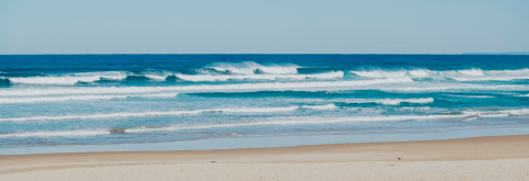
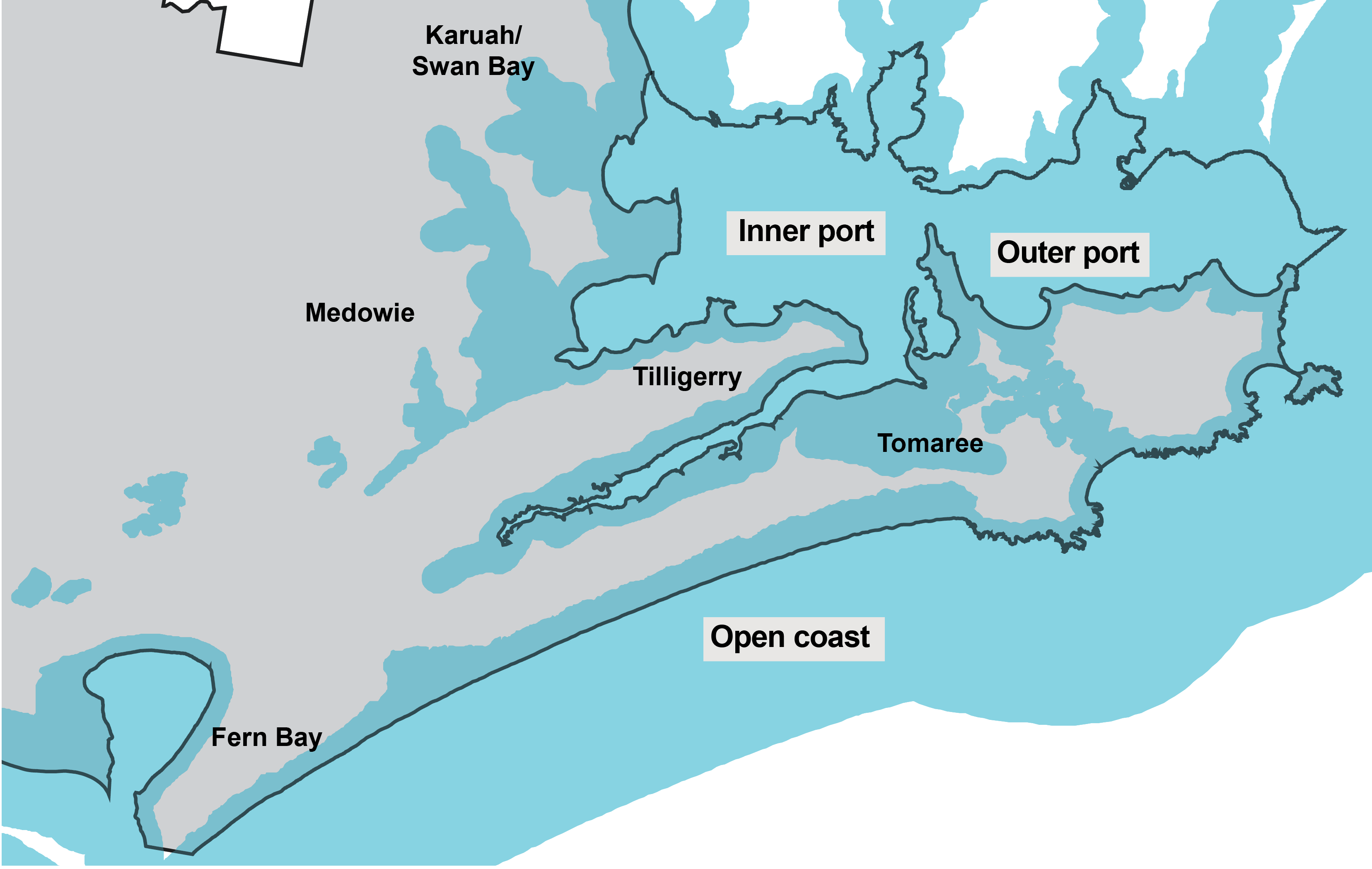
Port Stephens has a unique coastal zone – from its sandy beaches and rocky headlands to its mangroves, saltmarshes and seagrass beds. It stretches from Fern Bay in the south to Yaccaba Headland in the north, including the estuary of Port Stephens. The Port Stephens CMP study area covers the open coast, inner port and outer port within the Port Stephens local government area.
Our coastal zone is mapped below in blue.
Other coastal areas of Port Stephens are covered by a separate CMP called the Hunter Estuary CMP. Maitland City Council is leading the development of the Hunter Estuary CMP supported by the Hunter Estuary Alliance (HEAL). HEAL is directed by City of Newcastle, Port Stephens Council, Maitland City Council, Cessnock City Council, Dungog Shire Council, Hunter Local Land Services, Hunter Water and Department of Planning & Environment.
The Hunter Estuary CMP is currently finalising Stage 1 outcomes and moving into Stage 2. You can learn more about this CMP by visiting Maitland City Council’s website here: www.maitland.nsw.gov.au/projects/hunter-estuary-coastal-management-program
Coastal zones are continually changing. It's important to have an understanding of the risks and hazards associated with coastal zones to enable better planning, management and continued enjoyment of the coast now and into the future.
Council is developing our CMP in line with the Coastal Management Act 2016 and according to the NSW Coastal Management Manual's five-step process. This CMP is not just for Council use but has been designed to guide the management of the coast for all our community.
Existing infrastructure such as houses, commercial developments, roads, stormwater and sewerage systems along some parts of the coast are at risk from these coastal hazards. With climate change and sea level rise, this risk is projected to grow over time increasing exposure along the open coast and low-lying parts of estuaries. There are also risks to coastal biodiversity values, and to social values such as cultural heritage, public access and our enjoyment of beaches and coastal areas.
In the face of these environmental and development pressures, we need a modern, integrated framework that is up to the challenge of meeting our current needs and equipping us to face future challenges.
The CMP will identify coastal management issues in Port Stephens, the actions required to address these issues, and how and when those actions will be implemented. We will also identify the costs of the actions, proposed cost-sharing arrangements and viable funding mechanisms to ensure the delivery of our CMP.
Once certified by the Minister for Local Government, Port Stephens Council will implement the actions within the CMP through our strategic management systems and land-use planning instruments. Completion of the Port Stephens CMP is estimated to be in early 2024.
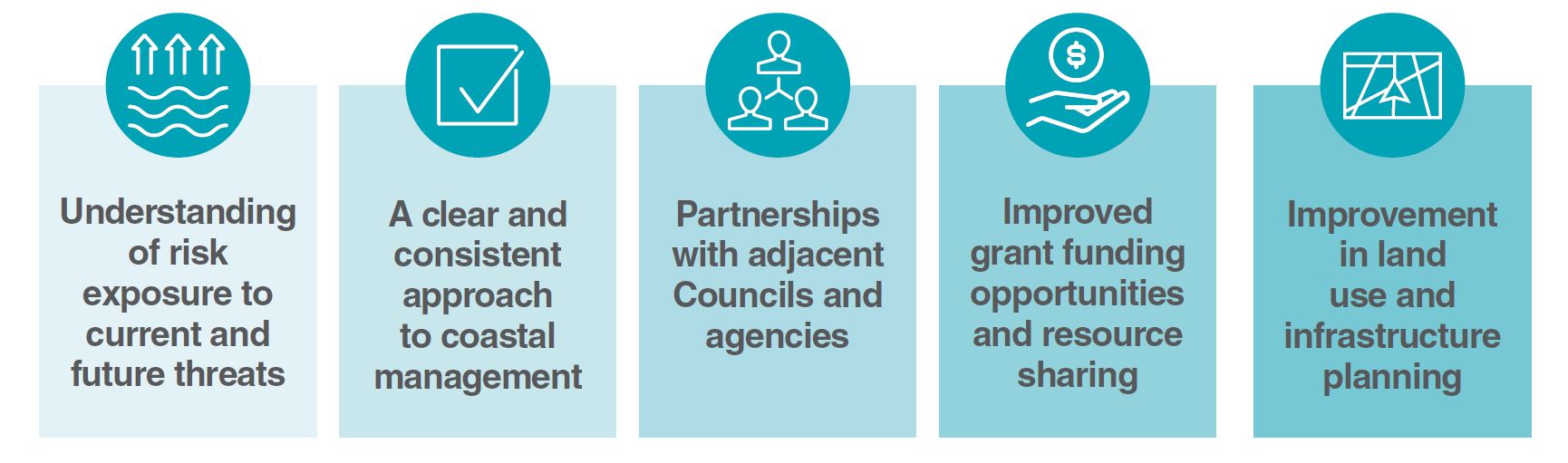
In summary, some of the key benefits of having a certified CMP in place are:
The Scoping Study, which comprises stage 1 of the CMP process, identified a range of priority threats affecting the Port Stephens coastal zone. These included:
- Coastal hazards such as coastal erosion, coastal inundation, tidal inundation and dune transgression;
- Coastal structures and other activities on private land that extend onto public land, impacting public access and the environment;
- Water quality impacts arising from diffuse sources of pollutants (urban and agricultural stormwater runoff), as well as point sources such as marinas and on-site sewage systems;
- Acid drainage from acid sulfate soils; and
- Biodiversity impacts associated with land clearing, pests, weeds and disease.
All of these threats also have implications for the numerous and highly significant cultural heritage values of Port Stephens. These values, sites and resources have historically been managed by the Worimi, the Traditional Custodians of the coastal zone, who continue to manage the land and sea today.
Port Stephens Council is developing the CMP to provide a framework for managing these priority coastal threats now and into the future so we can all enjoy the benefits of the coast for years to come.
A copy of the Scoping Study can be found below:
- Coastal Management Plan Scoping Study – Stage 1 (PDF 1.6 MB)
Community engagement is an integral part of the development of the CMP. For stages 1 and 2 we have sought input from our community to:
- Gain a perspective of the characteristics that are valued by the Port Stephens community and NSW stakeholders, and how this will dictate threats to management and the priorities for locations in the future.
- Raise the profile of the CMP and awareness of Coastal Zone to community at a number of local events.
- Increase the understanding of our identified coastal hazards (see our videos page to catch up on the webinars).
Community engagement and consultation is currently live at the moment for Stage 3.
In addition to community engagement, we will work closely with the range of stakeholders involved in coastal management, such as the Local Aboriginal Land Councils and Traditional Owners, Marine Parks and NSW Fisheries, and National Parks and Wildlife Service.
Stage 4 of the CMP will be the formal public exhibition period of the draft program.
In order to guide the development of the CMP, Council has reviewed the outcomes of Stages 1 and 2 and community feedback received to date to develop a vision for the management of the coastal zone as follows:
Our community is resilient to environmental risks, coastal hazards and climate change.
The purpose of the CMP is to provide a framework for the management of coastal hazards, issues and risks to the Port Stephens coast zone in line with the community’s needs, and state objectives and legislation.
In doing so, Council commits to the following principles:
- We will consider the unique character of each place
- We will be fair and equitable in outcomes and decisions
- We listen, value and respect community input and feedback
- We will prioritise community safety in our planning and decision making
The vision and principles have been translated into a series of management objectives for the CMP, detailed below. These objectives will be used to evaluate potential management options and measure the success of the CMP in the implementation phase (Stage 5).
Collaboration
Encourage collaboration and partnership with government, agencies and our community to manage and protect the coastal zone.
Biodiversity and ecosystem integrity
Protect biological diversity and ecosystem integrity by maintaining and improving water quality and estuary health.
Climate change
Mitigate and build resilience to current and future coastal hazards and risks.
Land use planning
Facilitate ecologically sustainable development in the coastal zone and prioritise sustainable land use planning in decision-making to maintain and improve public access, amenity and use.
Aboriginal Custodianship
Support and protect our Aboriginal community’s spiritual, social, customary and economic use of the coastal zone.
Coastal economies
Support sustainable economic opportunities within the coastal zone.
We are still developing the CMP, so nothing has changed for you yet! It’s just that we now know more information about where our coastal hazard areas are and what the potential impacts might be. Stage 3 of the Port Stephens CMP will look at potential options for managing coastal hazards and other risks, which could include land use and development controls for properties subject to coastal hazards. Any such development controls would likely require additional considerations in any new development or major renovations to your property aimed at better protecting your safety and your dwelling from coastal hazards.
At present, it is not stand practice for insurers to offer cover for what is referred to as ‘Actions of the Sea’, and landowners are encouraged to discuss their current level of insurance with their insurers. The coastal hazard mapping for Port Stephens is unlikely to be new information to your insurers. Information is currently available to your insurers through studies undertaken on their behalf and via publicly available information, such as that on coastalrisk.com.au.
Further information can be found at the Insurance Council of Australia’s Climate Change Impact Series: Actions of the Sea.